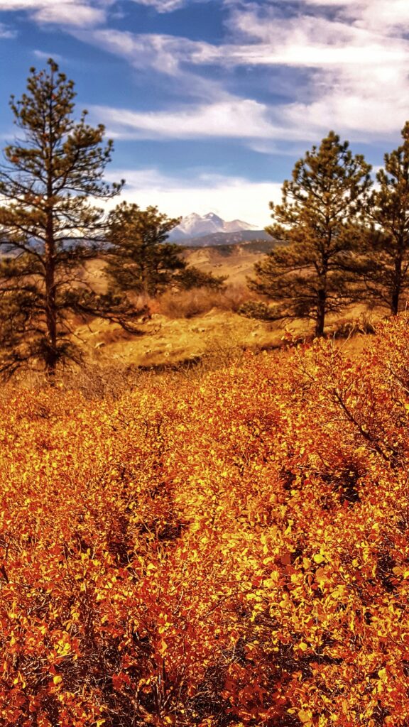
The fall colors are covering the mountains of Northern Colorado. While hiking outside of Lyons this weekend, we came across this view of the mountains while on the Rabbit Mountain Trail. Linda, along with friends Bob and Bev, decided to get out of town for a few hours and enjoy the trails. This photograph is looking west toward Rocky Mountain National Park.
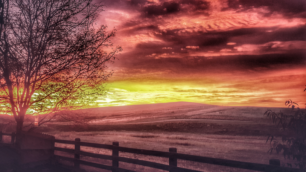
Sometimes you don’t have to travel far to find beauty. For this photograph, I traveled out our back door onto our patio. Our house backs up to open space and a mountain bike park, here in Erie, Colorado. While drinking a cup of coffee one morning, I looked out the back door. The hills are to the east, and this sunrise is what greeted me that morning.
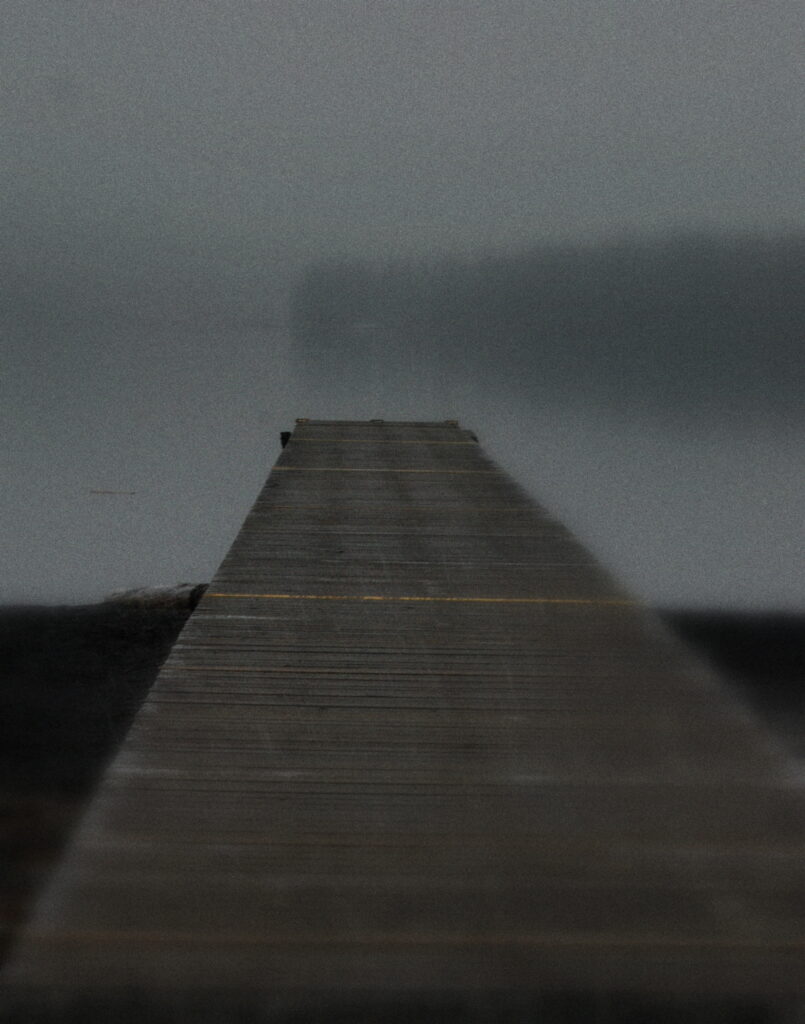
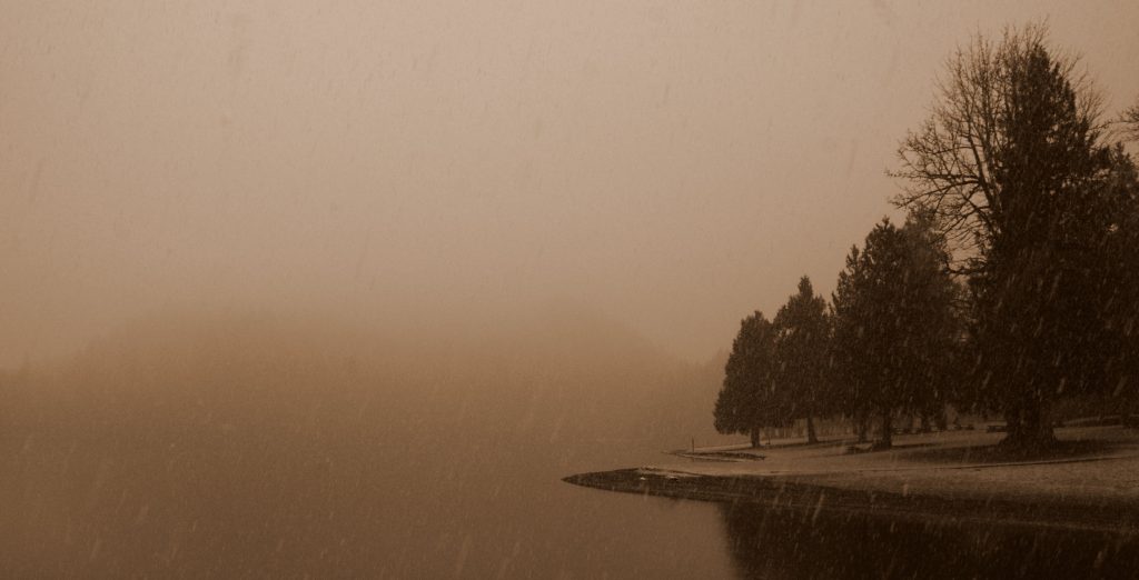
Cultus Lake lies about 10 miles south of Chilliwack, BC, Canada. I was working in Chilliwack, supporting a call center for Hewlett-Packard Retail Photo Centers. My work ended early on Monday, the 21st of February. Rather than going back to my B&B and chilling (easy to do in Canada in February), I quickly donned warm clothes and drove south, crossing the Vedder River, to Cultus Lake.
I drove along the east side of the lake, stopping here and there to explore the shores. About halfway down the length of the lake, while driving on Columbia Valley Road, I found a small pull-out, complete with a beach and dock. I walked along the beach for about 30 minutes when the snow began to fall. These three photographs are taken from the beach. All were taken while holding my camera (no tripod).
Sometimes the best travel photographs can be made right outside your back door. This is literally right outside our back door – OK, about a half-mile up the trails.
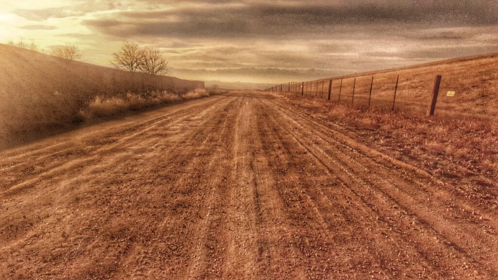
The end of County Road 6.
We live up against the Sunset Park West mountain bile park. One-quarter mile past is the Sunset Park East mountain bike park. On the 18th of December, I rode from our backyard, up the trails in the West park, up to the East park, and rode, jumped, and flew over the trails. On my way back home, I stopped, took out my phone, and made this photograph. It is looking west over the town of Erie.
I took a trip down to Arizona in December with Linda, to visit her son in Tucson. After a short stay in Mesa with good friends, we headed to Tucson for a few days of rest and relaxation.
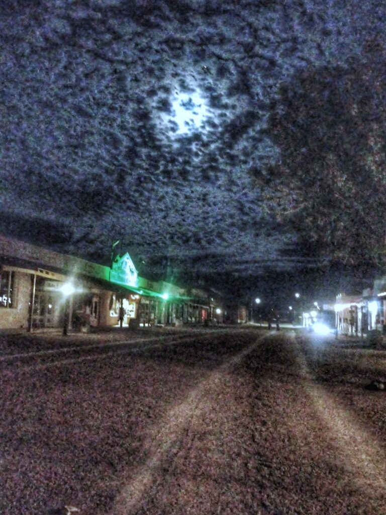
One day, I convinced Linda and David to explore Tombstone with me. I have a long history with Tombstone. My grandparents retired there back in the 1960s, and my family made many visits to “The town to tough to die”.
The three of us wandered the streets for a bit, and stopped in the Crystal Palace for a sasparilla. As we were leaving town, I looked down Fremont street toward the OK Corral, just as a storm was brewing in the distance.
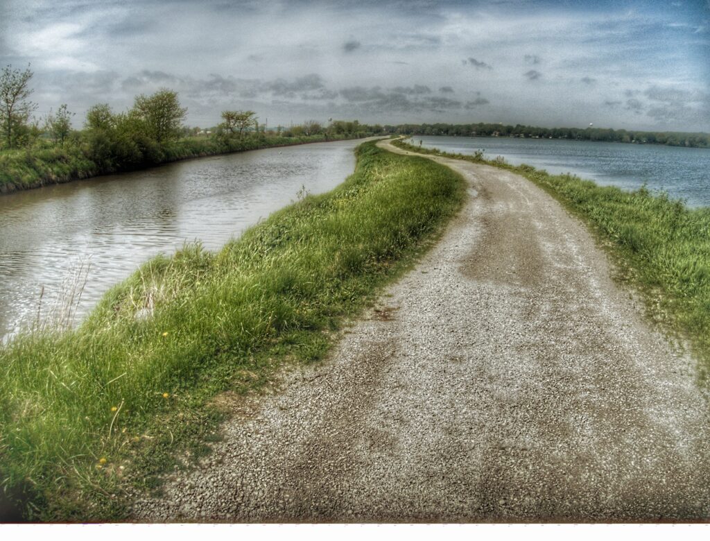
County Road K wasn’t bad. A few potholes here and there, and it had its share of dead animals, but for a road in rural Missouri, it was looking better than I had imagined. Recently, I had been on several back roads in Missouri. The recent rains and flooding were taking their toll, and many of the roads were in disrepair.
County Road K.
The rainy season is not the best time to visit the Mississippi River valley, but when work calls, I pack my bag and go where I’m needed. I was needed in Hannibal, Missouri, and Davenport, Iowa for two weeks. I packed my bag and went. It rained the day I arrived. It rained the day I left. And it rained several of the days in between.
I landed in St. Louis on a Monday afternoon. It was cool, but not cold, and clouds filled the sky. I showed up at the car rental lot to grab a car. The agency I use lets me pick whatever car I want. I was in luck that day. Because of the rains, there was a new Mustang convertible in the lot. Who wants a convertible when it’s raining? I mean, besides me. Ten minutes later, I was traveling north to Hannibal.
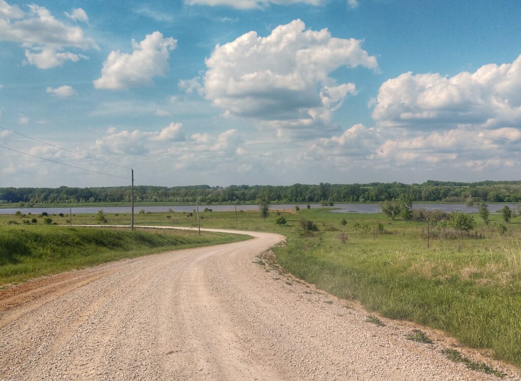
There are several ways to get to Hannibal from St. Louis. My least favorite is to take U.S. 61, a fast, ugly road with no imagination. My favorite is to cross the Mississippi River into Alton, Illinois, and follow the rivers (the Mississippi and the Illinois) all the way to Quincy, where I usually stay when working in Hannibal. My second favorite route, the one I’ve driven the most, follows State Highway 79 along the Mississippi, all the way into Hannibal. My two favorite routes had varying degrees of water on the roads from flooding, and I refuse to drive Highway 61 unless there is no other way. I found another way. County Road W.
County Road W.
County Road W is a lovely, two-lane road that passes by farms and through dells, and over small creeks. It meanders far enough away from the Mississippi River to avoid flooding. I knew that there were areas along Highway 79 that were closed. I also knew that If I could make it to Clarksville, I would be able to get to the town of Louisiana, where I could cross over the river into Illinois and make it safely to Quincy. With these bits of knowledge, I jumped onto State Highway 47 near Winfield, Missouri, and then onto Road W just outside of Chantilly.
Most of the small towns along Road W, such as Chantilly and Snow Hill, and Paynesville are just that; small towns. There are no places to stop to eat, no gas stations, and many don’t even have a bar. They are places where a few people call home and probably have for many years. There is, however, much to see. And there was no flooding. I rode W through Turpin north into Clarksville, and ten miles north on 79, I crossed the Mississippi River into Illinois. An hour later, I pulled into my hotel in Quincy. Thus, began my latest trip to the heartland.
This latest trip was comprised of two weeks of work; the first week in Hannibal and the second week in Davenport. Work started early that first Tuesday morning and I kept busy until Friday afternoon. By 1:00 PM on Friday I was done and ready to move on to Iowa. My destination for the weekend was a bed and breakfast in Amana, Iowa. I had never been to the Amana Colonies before and had not heard much about them. When looking for a place to rest for the weekend, I consulted Google, searching for quaint places between Hannibal and near Davenport. Amana registered high in the search, I liked what I found, and booked a weekend at the Village Guest Suite.
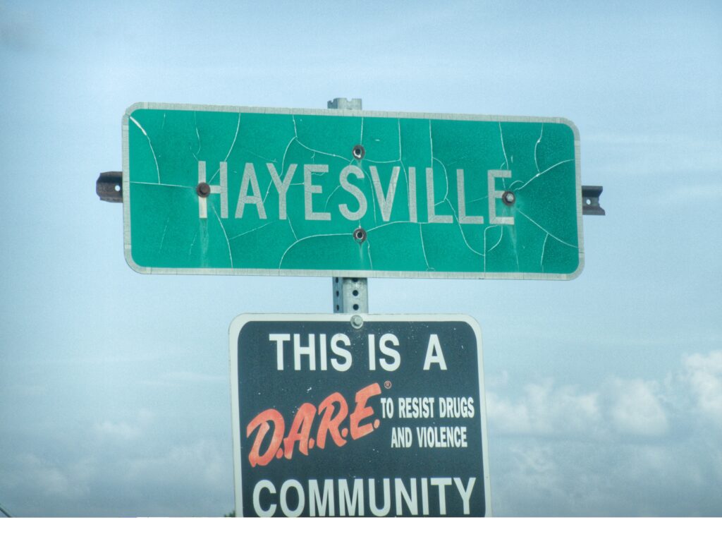
The evening before traveling to the Village Guest Suite, I pulled up a map on my laptop and began looking for less-traveled roads. As I was perusing the map, I saw a small town in southern Iowa that called my name. It literally called my name. Hayesville. I had to go. It was only about 150 miles out of the way. I had time. I had fuel. I had coffee. And I had a convertible. And so I went.
I left work and drove up US 61. I know I said I do not like 61, and I still don’t, but it was a short drive to Keokuk and the road wasn’t quite as ugly. I figured I would quickly get up the road, grab lunch, and make my way to the backroads of northern Missouri and southern Iowa. It didn’t take long to get to Keokuk, and I found a truck stop off the highway that had a Denny’s Restaurant.
I loathe chain restaurants about as much as I do interstate highways, but I saw nothing else around. I parked the car, put the top up, and made my way into the restaurant. I quickly got a booth and ordered a salad. I was quite hungry and looked forward to a quick meal so I could get back on the road. I didn’t get my quick meal as I thought. My salad took over 30 minutes to arrive. I was close to getting up and leaving when the waitress finally brought it. It was a good salad though and filled me up. By 3:00 PM, I was back in the car, top down and shoes off, heading west on US Highway 136. This highway was nice. Less traffic and better scenery. I rode it for about 30 minutes until it intersected with County Road K. This is the road I planned on taking into Iowa and toward Hayesville.
Somewhere near Hayesville.
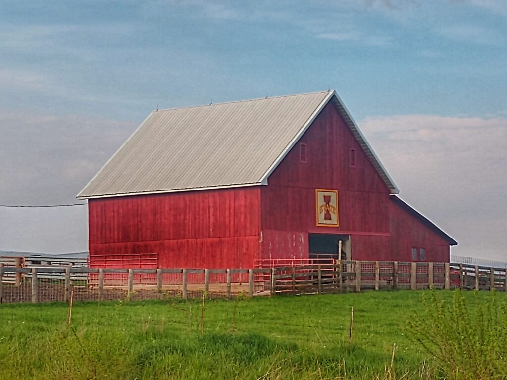
Northern Missouri is okay. Southern Iowa is better. Much better. There was a noticeable difference when I crossed the state line. It’s hard to explain, but I’ll try. Missouri is like the scruffy teenager who comes to your door when you’ve ordered pizza. Iowa is like the clean-cut Mormon missionary who comes to your door to sell you religion. The rural roads in Missouri are tidy. The rural roads in Iowa are clean. It’s as if once a week, people knock at the Iowa state line, say “Housekeeping”, and proceed into the state, cleaning as they go. Even though when County Road K crossed the line and became a dusty dirt road, it was a better road. And beautiful. I was surrounded by farms and cows and lakes and woodlands. All was spotless. The housekeepers must have just been through.
County Road W20 in Iowa.
The differences in the area became even more noticeable about 13 miles into Iowa. Roads became smoother. Farms became prettier. Whereas Missouri had old barns with peeling paint, Iowa’s old barns were freshly painted, and most had a design, usually a patch of painted quilt, but many with the emblem from either the University of Iowa or Iowa State. I learned about why these differences are there from someone I meet the following day at a brewery in Amana. More on that in a bit.
Go Cyclones.
My destination was Amana. But as mentioned earlier, I took an unusual route, one that took me to Hayesville and beyond. I crossed the Iowa state line near Mount Sterling. Here, Missouri County Road K became Iowa W20, and turned to dirt. I drove north on W20, kicking up dust and passing several groups of teenagers tearing up the road on their ATVs. I passed several large farms, stopped to make a few photographs, and eventually found State Road 2. I missed a turn on 2 trying to find State Road 1, and ended up following 2 east for several miles, passing through Milton and Pulaski and Steuben into Bloomfield. There I caught US 63 north to Ottumwa, crossed the Des Moines River and continued until I found State Highway 141. This was a typical road in rural Iowa; two lanes with no shoulders, surrounded by cornfields and farmhouses. I had to zig and zag more than once to find County Road 21, and then zag and zig to get onto farm road G48. The road to Hayesville.
Entering (and leaving) Hayesville.
Hayesville is small. The 2017 population figure was 49 people. I counted none. I stopped in the city park, which at one time was a school. Since there aren’t enough kids to teach in Hayesville anymore, the school is closed and the kids are probably bussed to a nearby community that has more than 49 people. Again, I stopped to make a few photographs, walked up and down Main Street for two minutes (that’s all the time it took to walk up Main and back down Main), climbed back into my car and headed east out of Hayesville toward County Road 149 (somehow it magically appeared east of town when it was west of town a few minutes earlier). I passed one truck on my way out of town and waved to its lone driver, possibly a resident of Hayesville, and perhaps a distant relative of mine. He looked at me, smiled, and waved back. He didn’t much look like me, so I guess he was from another Hayes clan.
Hayesville to Amana took about two hours, as I followed more back-roads and side roads and county roads, staying off any major roads. The temperature dropped from over 85 degrees to around 60 degrees in 30 minutes. I briefly thought about pulling over and putting the top up on the car. It was a passing thought, and I quickly dismissed it. Rain clouds filled the skies to the north, but not over me, as I meandered through farm country. I pulled into Amana at 7:30 PM, just as the first drops of rain splattered on my windshield. I pulled into the parking area of the Village Guest Suite Bed and Breakfast, raised the top, grabbed my bag, and made my way inside to check-in for the weekend. I was met by Virginia, the innkeeper, who welcomed me to Amana. I asked about a place for dinner.
“You’re just in time. All of the restaurants here stop seating people at 8:00. I work at one. It’s quite good if you like German food.”
I thanked her for the recommendations, grabbed my raincoat and wallet, and walked the four blocks to the Ox Yoke Inn, the restaurant where Virginia worked. I arrived just before they stopped serving and had a great German dinner and beer. Outside, the rain started coming down in buckets, and I was glad I grabbed my raincoat. The meal and beer made for a perfect ending to my day on the long road to Amana.
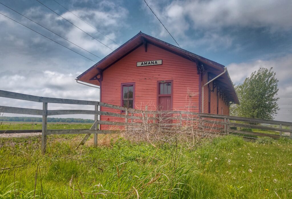
Amana Railroad Station.
I promised you I’d tell you about the differences between southern Iowa and northern Missouri, as heard from a new acquaintance I met the next day. It goes like this.
I was finishing a long walk in the countryside that Saturday morning. I wandered back into Amana from the south, passing the old (and shuttered) railroad station. As I approached town, I heard the familiar sounds of German music. I rounded a bend and found myself in front of the Millstream Brewery. Never one to pass a brewery, I went inside and ordered a pilsner, and then proceeded to the open patio overlooking the Mill Race creek. A couple, along with their basset hound, was seated a table away, enjoying a pitcher of wheat beer. I made a remark about their dog’s sad eyes, and the fact maybe he wanted some beer. We struck up a conversation, and before I knew it, I was sitting at their table drinking beer and telling stories. I told the story of driving up through Missouri and how much I noticed the gradual difference between Missouri and Iowa. Jim, who hails from Iowa told me about the Honey War of 1839.
The Honey War was a bloodless dispute between what was then the state of Missouri and the Iowa Territory. The dispute was over a 9.5-mile-wide swath of land between the two. It was called the Honey War because the only three casualties were trees that contained beehives. In the end, the Supreme Court sided in Iowa’s favor, and a 30-mile-wide stretch of land from the eastern border to the western border became part of Iowa.
“That’s why the difference in people and land is gradual.” Jim, my new drinking buddy said. “People from Southern Iowa are really Missourians.”
With a somewhat amused look on his face, Jim took a swig of beer and said “A lot of folks around here wish we’d of lost that war. Me included.”
I’m back in Missouri. Actually, I’m back in Illinois, driving north to Quincy, where I’ll spend the week working in Hannibal, Missouri. I’ve been working on and off in Hannibal for the past four years. Some things remain the same. But some things change all the time. The roads I take from St. Louis to Quincy are a good example.
Today starts the fifth time I’ve worked in Hannibal this year. I always drive from St. Louis and I always take the less-traveled roads. My favorite itinerary takes me across the Mississippi River into Alton, Illinois, where I find farm roads that eventually take me north to Quincy. The last three trips I’ve made to Hannibal were during the flooding season, and the bridge from St. Louis to Alton was closed due to high water or damage to the bridge. Today the bridge was open. I crossed into Illinois, stopped in Alton for a beer and burger at Fast Eddies, and then wandered small roads northward. I followed Highway 100 to Elsah, and then cut inland for a while, paralleling the Mississippi River, as I ventured by cornfields and vineyards. I jumped back onto Highway 100 at Grafton, and drove north toward Pierre Marquette State Park.
Stopping at Fast Eddies.
One of my favorite roads is near there. One must take the Brussels Ferry across the Illinois River to get to the “Land Between the Rivers”. An inland peninsula is formed between the Mississippi River on the west and the Illinois River on the east. It’s almost a different state. There are no major roads, no large cities, and no real reason to travel between the rivers unless you live there, work there, deliver goods there, or want to see some beautiful scenery.
The ferry crosses near the town of Quarry, and dabbles along Highway 1 for thirty-some miles, eventually passing through Brussels and Hardin, then past Michael and Kampsville. Highway 96 then traverses west and north past Mozier and Belleview on its way to Quincy. I’ve made this trip two or more times and love the solitude. Not many cars drive along Highway 1 between Quarry and Hardin. It was an hour before dusk, and I had the road almost to myself.
I passed through Brussels around 5:00 PM, heading north to Michael. I am usually not a creature of habit, but I always stop at the Michael Tavern for an ice-cold glass of Stag Beer. Just so you know, Stag is not the best beer in the world. It’s actually not that good at all. I stop in Michael not for the beer, but for the memory. Back in 2016, I was driving down from Quincy to St. Louis. It was the first time I’d taken this route. It was mid-July and the temperature hovered around 103 degrees Fahrenheit. I rounded a bend in the road and found myself in Michael. The town of Michael consists of a bar and a bait store. The bar has a large logo for Stag Beer painted on the side. I was hot, the beer was cold, and I stopped. For two-and-a-half bucks, I got a glass of Stag in a chilled glass. It was just what the doctor ordered.
I digressed. Where were we? Right. I was heading up the road toward Michael. I passed a sign for Batchtown, a small town on the Mississippi River side of the peninsula. I had never driven that side before. A voice in my head said I should have turned left onto Highway 6. Three seconds later, another voice in my head said “Make a U-turn.” I did.
Highway 6 travels west into Batchtown and turns into Main Street. This is where I passed Batchtown Motors. At one time, it was the largest car dealership between the Mississippi and Illinois Rivers. But hard times hit Batchtown, the six-lane expressway was never built, rusted-out minivans lost their appeal, and Batchtown Motors is not what it used to be. (I made all that up, by the way).
Best deals in town . . .
After Batchtown, the highway turns north and becomes Highway 2 – The Mississippi River Road. Calling it a road is a stretch. It’s mostly paved, with a few areas of loose gravel, probably due to the recent flooding. The road is barely one-and-and-a-half lanes wide all the way up to Hamburg and beyond. It weaves and bobs and curves through woodlots and cornfields and by small farms and houses. Approaching curves at a slow rate of speed is a must. If a semi-truck hauling a mobile home or a bunch of cows or perhaps an ICBM is coming from the opposite direction, you either need to back up for a while or drive sideways in a ditch.
Highway 2 near Hamburg.
I didn’t see any semi-trucks with mobile homes or cows or missiles. In fact, for close to an hour, I only saw two pickup trucks. Both old and both driven by old men. One truck was a Ford and the other a Chevy. The area is quite diverse. And lonely.
A lonely road.
I made my way past Gilead and through Hamburg. By 6:00 PM, I intersected with Highway 96 at Mozier. From there, the road for me was familiar; one I had taken several times before. I made Quincy by 7:30, ready for another week of work in Hannibal.
One of the great things about driving through the Heartland of America is that it is really hard to get lost. All you have to do is figure out which direction or directions you are going and start driving in one of those directions.
I pulled out of Hannibal, Missouri today heading to Davenport Iowa. Davenport is about 170 miles from Hannibal, or following the route I took, about 250. Davenport lies northeast of Hannibal. The beauty of the roads in this part of the country is that you can drive one direction for a while, north for instance, hop onto a road going the other direction, east in my case, and just keep zig-zagging until you get where you’re headed.
Illinois Barn.
I was lost a good part of my drive. I had no map, but my car did have a compass. I traveled north for a while until the road I was on kind of petered out. I turned right on a county road, the number which escaped me, and traveled east for a spell. I kept turning right and then left as roads either dead-ended or looked uninteresting. I traveled through small towns and by large farms. I passed more tractors than cars and I saw more cows than people. By 7:00 PM, after northing and then easting for five hours, I finally ran into the Mississippi River. I couldn’t go north anymore until I found a bridge, which I did by driving east for a few miles. North across the river and east into Davenport. I was no longer lost.
I had (took) an opportunity to wander around the Texas Hill Country for a day. Playing hooky from a conference in Houston, I hopped in my rental car early Tuesday morning, heading west on a backroad (Farm Road 1093) toward Shiner, Texas. My plans were to find ill-traveled roads, small towns, and eventually, the Spoetzl Brewery in Shiner.
My first stop was a filling station outside of Fulshear. I didn’t need gas. I needed coffee. The small cup of coffee I filled at my hotel didn’t last long and I was in need of more go-juice for the road. I knew that I would not find a specialty coffee out in the rural area of East Texas. No Starbucks or Caribou brewed lattes. What I did find was the coffee that I grew up on – cooked (almost charred) coffee, served up in a tall Styrofoam cup. Hi-grade caffeine, like the stuff I drank years before while in the Air Force. No additives needed.
I entered the small store attached to the filling station, expecting to be greeted by a smiling Texan, saying “Howdy. Welcome to Fulshear. What would y’all like today?” or something like that. Maybe a middle-aged woman – probably a nice Baptist woman, happy to be living in rural Texas. Or perhaps an older gentleman, wearing a large Stetson hat, talking about land and horses and oil. Instead, I was greeted by an Indian. From India. Listening to a radio station in Hindi. He smiled and welcomed me, and had nice words for me as I paid for my 40 ounces of black coffee.
Later that morning, I was passing through Weimar, a small town on Alt-90. I wasn’t particularly hungry but as I drove past K and B Donuts, the thought of a good jelly donut or maybe a bear claw made me make a U-turn past the water park and go in for a donut. Weimar is an old town, founded by German immigrants in the early 1870s. Entering the shop, I again was expecting a greeting in a loud, Texas drawl. Instead, the shop owner was a middle-aged man from Vietnam. Small in stature, he was behind the donut counter, wearing a white shirt covered with various baking ingredients and a Santa Claus hat.
K & B Donuts.
I ordered a couple of bacon and egg tacos and bought a bottle of chocolate milk. I sat in the shop and ate one of the tacos and started a conversation with the store owner. I told him I liked his hat. He explained that it was cold earlier in the morning and that he liked the way the hat fit and felt. We talked about the weather, donuts, and Texas Hill Country. As I was leaving, he smiled and wished that I would have a good day wandering.
That evening, the State of the Union speech occurred. I didn’t watch it (still wandering) but heard much of its contents later that night. It contained so many negative aspects of immigration. Our country doesn’t need immigrants. They aren’t welcome. They should stay where they are. Etc. And I couldn’t help but think of the Indian man in Fulshear and the Vietnamese man in Weimar. And my mother, who emigrated from Germany. And my father’s ancestors, who emigrated from Ireland. All immigrants. And all living or lived productive lives here. To me, they are Americans. They are America.
Travels don’t always need to take place in far-off exotic locations. Sometimes they can be right around the corner. last week, due to work and weather, I was able to make a short hike along Big Dry Creek, which happens to be just down the street from our house. I had a three-hour conference call in the morning and another three-hour call in the afternoon. In between, I donned a warm coat and hat and wandered off into the snowy day.
Classic Camera Barn.
Not far from our house, a two-lane road follows the creek. A local photographer owns a portrait studio that overlooks the creek. His studio is housed in this old-looking barn. Quite a nice setup for producing photographs.
Train Tunnel.
Not far from the Classic Camera barn, the Big Dry Creek Trail drops under the railroad tracks. Looking west, the tunnel appears to lead to nowhere of infinity, depending upon your outlook.
Hawk.
I looped around onto the road and found a drive-thru coffee shop. Walk-thru in my case. I bought a hot cup of Joe and headed home. In the meadow near our home, I spotted this hawk, scanning the creek and nearby fields for a meal.
Big Dry Creek.
Just down from the path that leads back to our street, I stopped for one more photograph. The freshly falling snow on the creek made for a good indication of how cold I was getting. Time to go home, grab my phone, and take my last call for the day by the fireplace.